SIGN UP FOR OUR
Costa Rica and the United States Geological Survey (USGS) have agreed to develop a joint groundwater exploration and evaluation project to improve resource management and minimize the impact of climate change, reported the Spanish news agency EFE last week.
The Costa Rican Environment and Energy Ministry (MINAE) said in a press release that the Geological Survey expert, Saud Amer, who carried out several inspections in the country, presented a report in which he revealed that Costa Rica possesses the optimum conditions to develop the initiative.
“Within 14 months, Costa Rica will have available a national digital map, and an assessment of its aquifers, which represents an investment … in this vital resource: water,” said the MINAE’s water department head, José Miguel Zeledón.
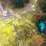
The purpose is to map the country’s aquifers and evaluate them using remote sensing guidance technology, called WATEX, which draws on national information and data on water to combine it with remote sensing data collected by satellite.
The project will improve knowledge about groundwater availability, and will also in the long run save time and money by improving the success rate for drilling wells, and allow for more effective management of groundwater resources to minimize future impacts of droughts and climate change events.
In addition, the project will improve access to water for the public, and provide an accurate groundwater maps to add in developing zoning plans that allow for the protection of water resources.
MINAE said the project will be financed with resources from the water use fee paid by all private and public subscribers for their water consumption, according to the report by EFE.